



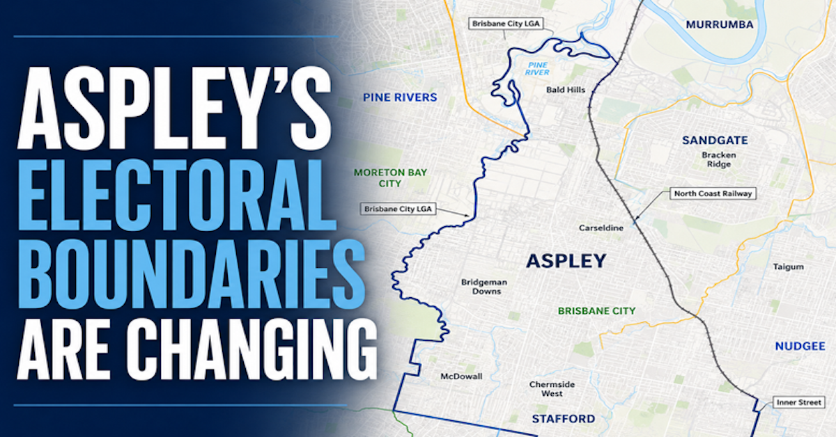
Parts of Chermside will move into the Aspley state electorate while areas around Albany Creek and McDowall shift out under Queensland’s redrawn electoral boundaries.
Queensland’s final electoral redistribution changes several edges of the Aspley electorate ahead of the 2028 State election. The final redistribution was published on 29 June 2026.

Chermside In, Albany Creek Out
Under the new boundaries, Aspley will gain the northern portion of Chermside from Stafford and the balance of Bridgeman Downs.
A portion of Geebung will move from Aspley to Nudgee, while part of McDowall and the section of Albany Creek previously within Aspley will move to Everton.
The changes leave Aspley centred on Aspley, Carseldine and Bridgeman Downs, while continuing to include most of Bald Hills and parts of nearby suburbs including Zillmere, Chermside, Chermside West and Wavell Heights.

A Minor Redraw Around the Edges
Queensland periodically reviews its state electoral boundaries to ensure districts remain within legislated enrolment limits.
The Queensland Redistribution Commission also considers communities of interest, transport and travel links, physical features, existing boundaries and demographic trends.
For Aspley, the changes adjust several edges of the electorate rather than fundamentally reshaping the district.


New Boundaries From the 2028 Election
The Queensland Redistribution Commission published the final redistribution in the Queensland Government Gazette on 29 June 2026.
The new boundaries will apply at the 2028 Queensland State general election.
Until then, the existing electoral boundaries remain relevant for elections held before the new boundaries take effect.